Creel
©
Creel

Creel

Pine-forest town at 2,300 metres, the base for Copper Canyon and the Rarámuri sierra

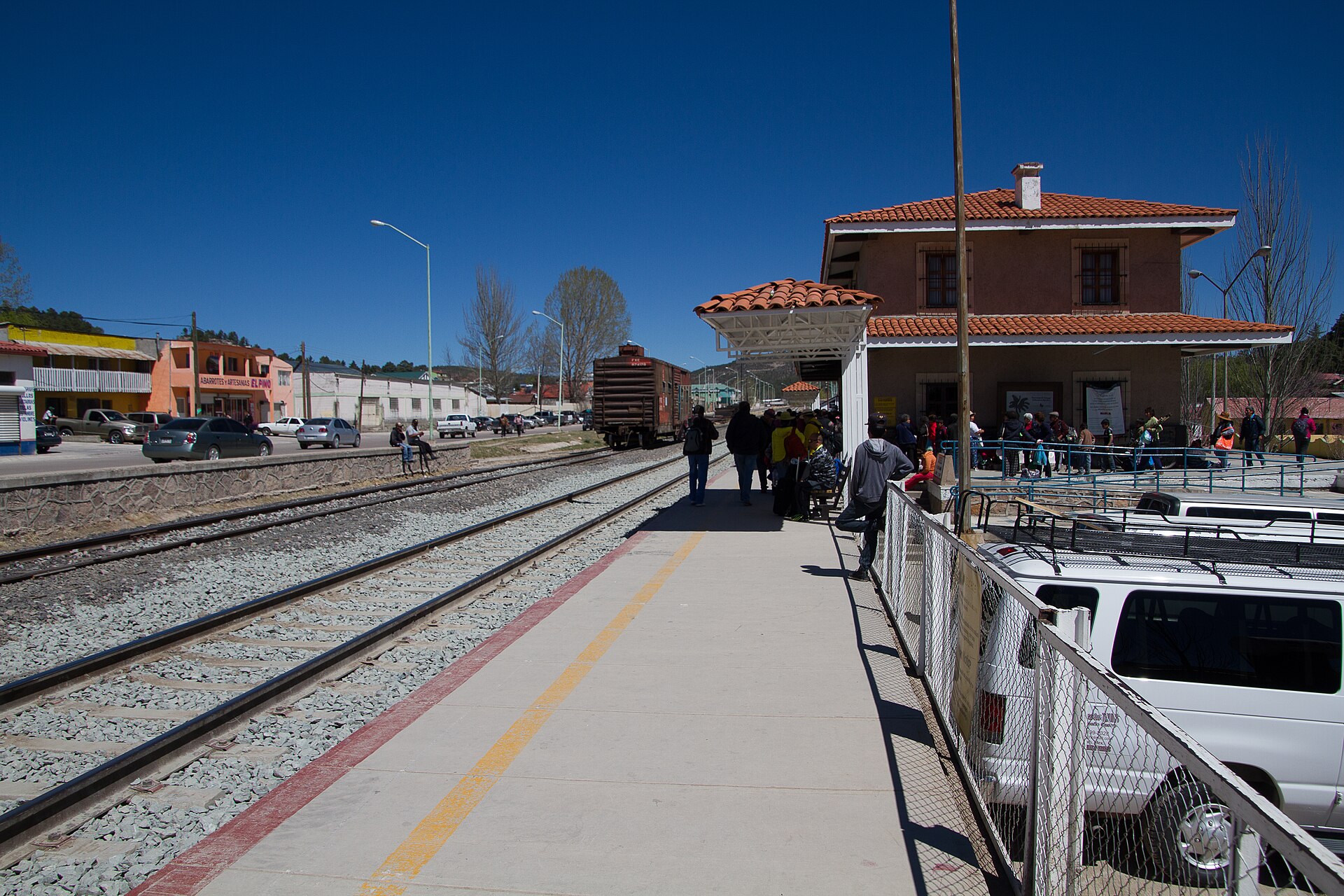
A lumber town of a few thousand people at 2,300 metres in the Sierra Tarahumara, strung along the railway line, and the place almost everyone uses as a base for Copper Canyon.

Creel is not pretty in the way the Bajío towns are pretty. It is a working place: timber yards, a wide main street, pickup trucks, pine smoke in the cold months. What it has is position. The Chepe stops here, the roads to the canyon rim and down into it start here, and the Rarámuri communities of the surrounding sierra come here to trade.

The Rarámuri — Tarahumara in the Spanish name, though Rarámuri is what they call themselves — have lived in these canyons for centuries, and in Creel you will see them. The town's visible economy includes the sale of their pine-needle baskets and woven belts; the less visible one is that the sierra is poor and the summers have been getting drier. Buy from the makers rather than from a shop, and do not photograph people without asking.

Around town, within an hour by road or on a rented bike: the Lago de Arareco, a quiet reservoir among pines; the Valle de los Hongos and Valle de las Ranas, fields of eroded rock shaped like mushrooms and frogs; the Cusárare waterfall with a Jesuit mission church beside it; and the Recohuata hot springs at the bottom of a steep descent.

It is cold here in winter and it snows. The canyon floors, a couple of thousand metres below, are subtropical in the same week — which is the strangest thing about this part of Mexico and the reason October and November, clear at both elevations, are the months to come.

Guide

Activities

Creel is a base, not a destination, and the operators here sell two sorts of day.

The short ones circle the town: the Lago de Arareco, the eroded rock fields of the Valle de los Hongos and Valle de las Ranas, the Cusárare waterfall and mission, and the Recohuata hot springs at the bottom of a steep walk down. Most of these can be done on a rented bike or a horse as well as in a van.

The long ones go to the canyon proper. Divisadero, an hour west, is the viewpoint where three canyons meet and where the adventure park has a cable car and the longest zip line in the world. Batopilas, five hours south down a road that drops 1,800 metres in switchbacks, is a silver town at the bottom of a canyon with a ruined cathedral in the jungle nearby — it is a two-day trip, not a day trip, whatever is advertised. Basaseachi, Mexico's second-highest waterfall, is the other long day, north-west.

Trips to Rarámuri communities are sold here too. The good ones go by arrangement with the community and leave money in it; the bad ones treat a village as a viewing gallery. Ask the operator who they work with and what the community gets.

The Chepe passes through Creel twice a day in each direction. Seats sell out in high season and on the first-class service, and the stretch west of here towards Divisadero and El Fuerte is the one worth being awake for.

Picked by people who know it

What most visitors miss

Know Creel?

Nobody has picked anything here yet. Tell us the one thing most visitors miss, or what we got wrong. We read every mail, update the guide and write back.